Compass
Compass familiarization
Look over every part of the instrument, then set its declination for this sheet.
Bezel 000° · declination 0°
Drag the compass to turn it in your hand and scroll to zoom. Drag the ring to turn the bezel, or flip it over and drag the brass screw to set the declination. Tap any component to inspect it.
Lesson 3 of 9
Compass Familiarization and Declination
- 1Find the compass panel on this page. Drag the 3D compass to turn it in your hand and scroll to zoom in on any component.
- 2Tap a component to select it. Its name, purpose, how it works and how it is used appear beside the compass.
- 3Drag the graduated ring to rotate the bezel and watch the graduation at the index line change.
- 4Choose Flip over to inspect the underside, where the declination screw and its scale are. Normal view brings it back.
- 5The same compass lies on the sheet in the map workspace, at the map's scale, where you can drag and turn it.
- 6Work through the identification exercise: tap each component it asks for.
The component in hand
Tap any component of the compass to inspect it.
Every component
Readings
- Bezel at the index line
- 000°
- Declination set on the screw
- 0°
Identify · 0 of 12 found
Tap the magnetic needle
The magnetised needle. Its red end points to magnetic north. Find it on the 3D compass. Flip the compass over if you need to.
Magnetic declination
- 1Grid north is the direction of the map's vertical grid lines. True north is the direction of the meridian to the geographic pole. Magnetic north is where the compass needle points.
- 2Magnetic declination is the angle from true north to magnetic north. The grid-magnetic angle (GMA) is the angle from grid north to magnetic north. They differ by the grid convergence.
- 3You navigate from the grid to the needle, so the GMA is the angle you apply. Use declination only when working from true bearings.
- 4Every angle here is signed the same way: east is positive, west is negative.
- 5Magnetic bearing = grid bearing − GMA. Grid bearing = magnetic bearing + GMA. An east angle is subtracted going to magnetic; a west angle, being negative, ends up added.
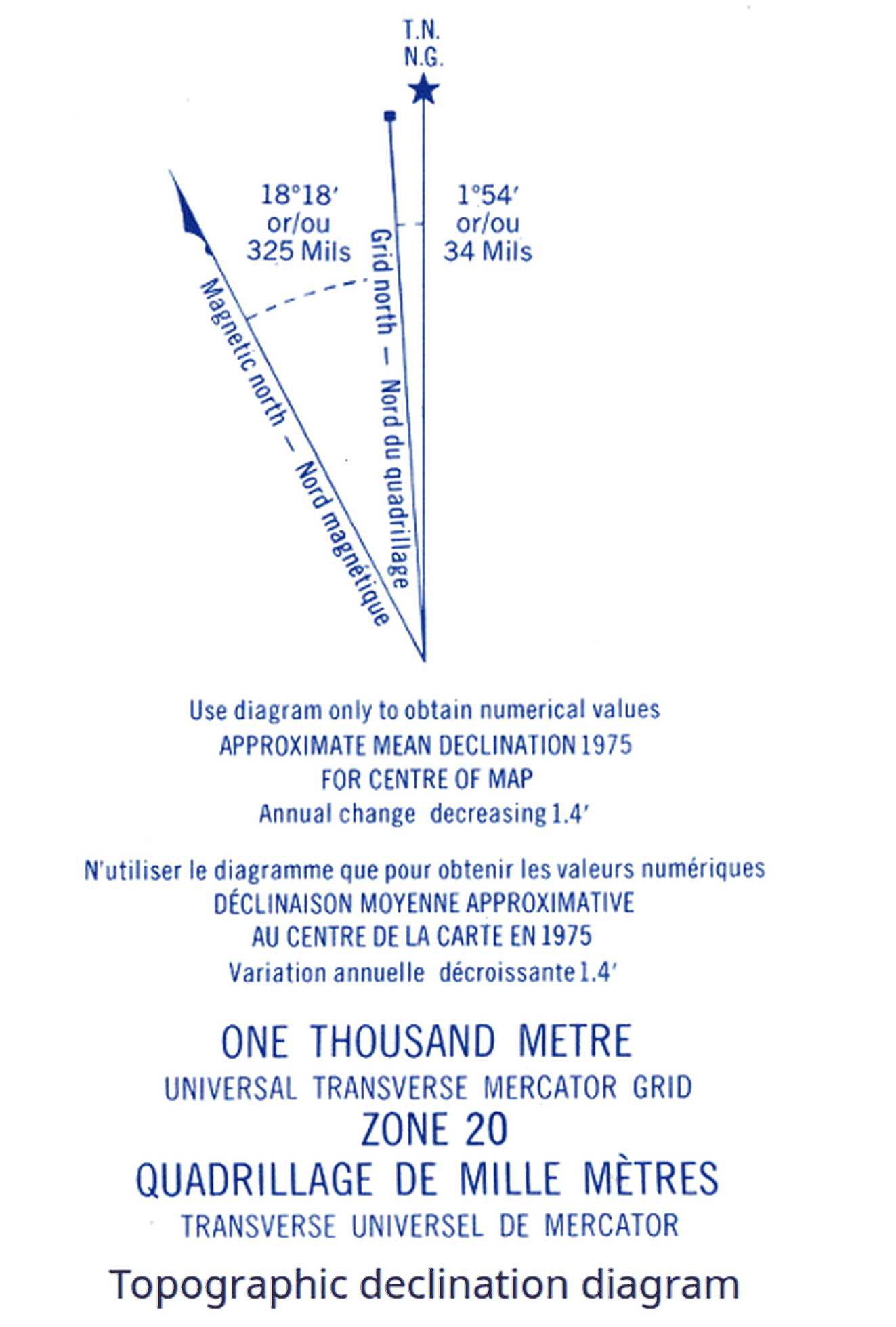
The three norths on this sheet
- Magnetic declination (TN to MN)
- 13.5° E
- Grid convergence (GN to TN)
- 0.1° W
- Grid-magnetic angle (GN to MN)
- 13.4° E
GMA = declination + convergence. This sheet lies close to the central meridian of UTM zone 12, so its convergence is small and the two angles are nearly equal. Farther from the central meridian they can differ by several degrees. The declination is a stated training value, not a current survey figure. The diagram is not to scale.
The margin of the map
The declination note, brought up to date
The bottom margin of every military map prints its declination: the angle when the map was made, the year, and how much it moves each year.
- Map data
- 2018
- Grid-magnetic angle
- 12.2° E
- Annual change
- 9′ E
- 1Years since the map was made: 2026 − 2018 = 8 years
- 2Annual change × years: 9′ (0.15°) × 8 = 1.2° E
- 3Add it to the angle printed on the map: 12.2° E + 1.2° = 13.4° E
- 4Set 13.4° E on the compass screw and the bezel reads grid bearings.
An east angle grows east: add the yearly change. A west angle is negative, so a westward change makes the number smaller while the angle itself grows. Turn the map over to see the screw and its scale.
Worked examples
- 1GMA 13.4° E, grid bearing 075°. Magnetic = 075 − 13.4 = 061.6°, set 062° on the compass.
- 2GMA 13.4° E, magnetic bearing 310°. Grid = 310 + 13.4 = 323.4°, plot 323° on the map.
- 3GMA 6° W (that is −6°), grid bearing 350°. Magnetic = 350 − (−6) = 356°.
- 4Grid bearing 008°, GMA 13.4° E. Magnetic = 008 − 13.4 = −5.4°, which is 354.6° once 360° is added.
Adjust the compass
- 1Beside the compass choose Declination screw. The compass turns over and the view closes in on the brass screw.
- 2Drag the screw left or right, or use the − and + beside “Declination set on the screw”. The pointer moves along the E and W scale.
- 3Set it to this sheet's grid-magnetic angle.
- 4Choose Normal view. The orienting arrow now sits east of the bezel's N by the angle you set, and it stays there in every later exercise.
- Set on the compass
- 0°
- This sheet's GMA
- 13.4° E
- Compass adjusted for this sheet
- No: the bezel reads magnetic bearings offset by the setting
With the needle boxed, the bezel reads the grid bearing of travel minus the GMA plus the angle set on the screw. At 0° that is the magnetic bearing; set to the GMA it is the grid bearing.
Solve for the missing value